We thank the municipality of Sernaglia della Battaglia for their kind collaboration.
Passo Barca
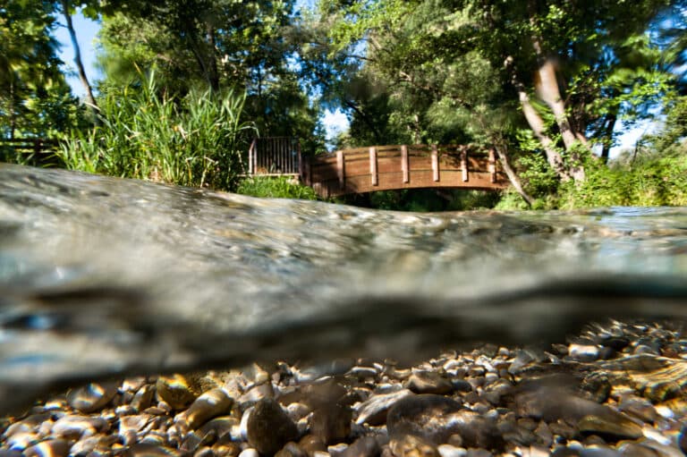
The starting point of the excursion is Passo Barca, a locality in Falzè di Piave whose name is linked to the important river traffic hub that arose on the left bank of the Piave, in the floodplain area where the riverbed narrows, facilitating the passage of ferries from one shore to the other.
The Piave, whose impetuous currents man learned to tame perhaps as early as the late Bronze Age, was one of the main communication and trade routes from the Dolomites to the Lagoon since ancient times, when the Veneto plain and mountains were covered with woods and forests.
You might also be interested in the Castelliere of Sernaglia della Battaglia
How to reach Passo Barca
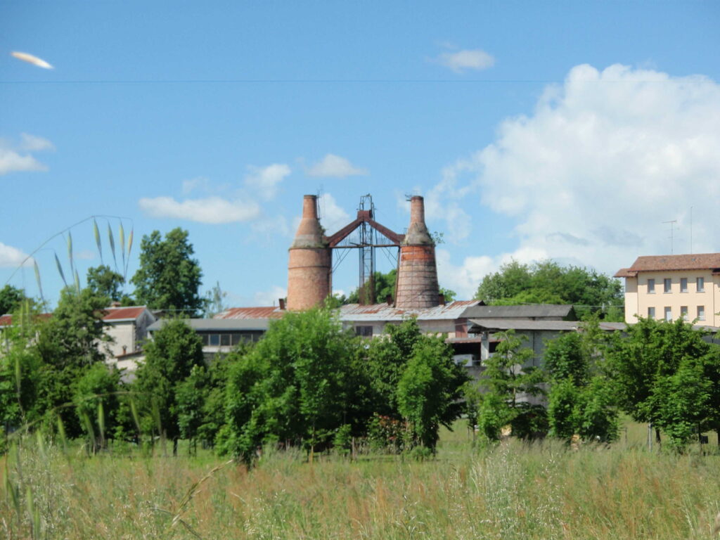
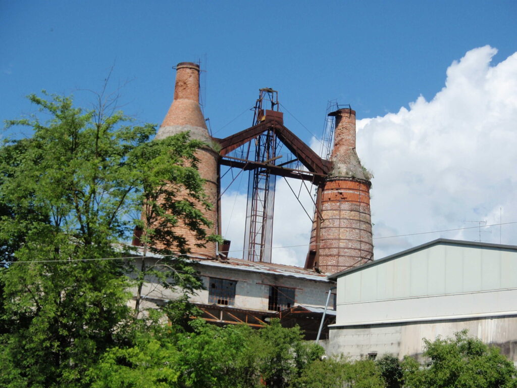
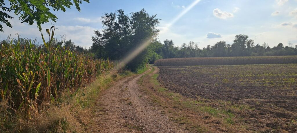
From Piazza Arditi we take Via Passo Barca and proceed 350 meters until we find, on our right, the Le Grave camper stop. A little further south we arrive at the large paid parking lot near the gravel beds of the Piave, where the two twentieth-century lime kilns of the Zottis family tower, soaring red brick towers whose fiery belly transformed millions of white river pebbles into quicklime, until the final closure of the plant in the 1980s.
From the municipal amphitheater to the fox caves
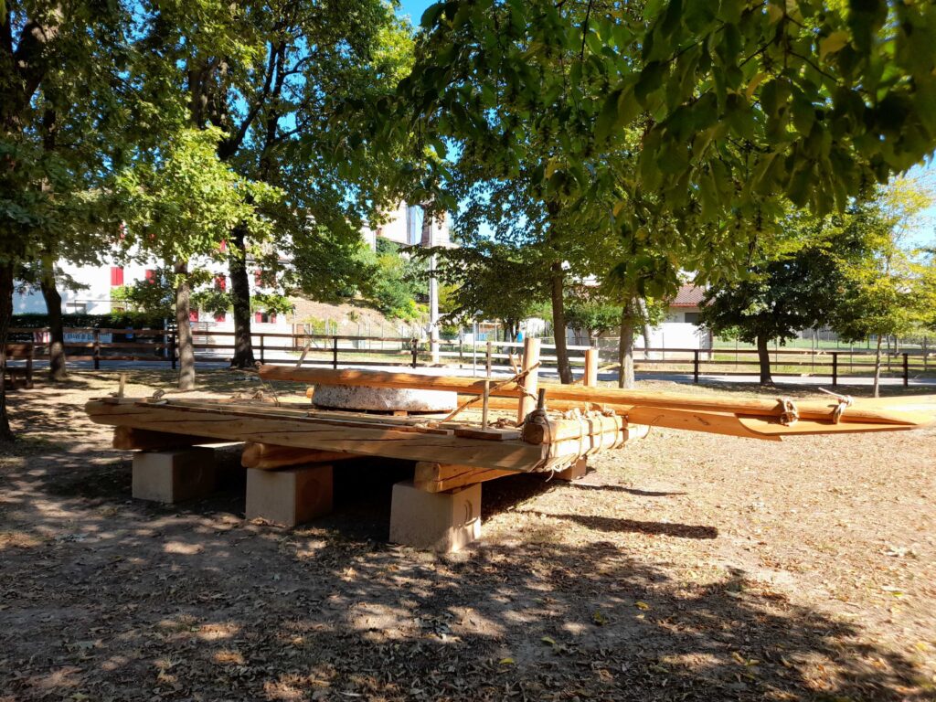
The rafts of Codissago
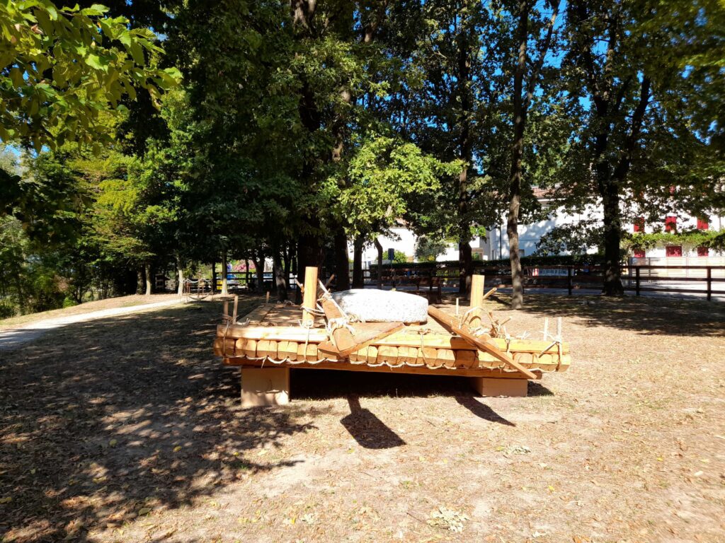
From the Falzè parking lot we follow the river upstream towards the municipal amphitheater. Shaded by poplars, black locusts, birches, field maples, walnuts, plane trees and many other lush tall trees, the trail winds along the edge of the green wooded mantle that surrounds a còpola, made by the Fameja dei Zatèr de Codissago, on which a millstone found on the bed of the Piave is placed.
The còpola is each of the five sections that make up the raft, a flat-bottomed boat designed to navigate shallow waters, whose oars have a trapezoidal blade. Each module is made up of about twenty logs 420 cm long, pierced at the ends and tied with debarked and twisted shoots.
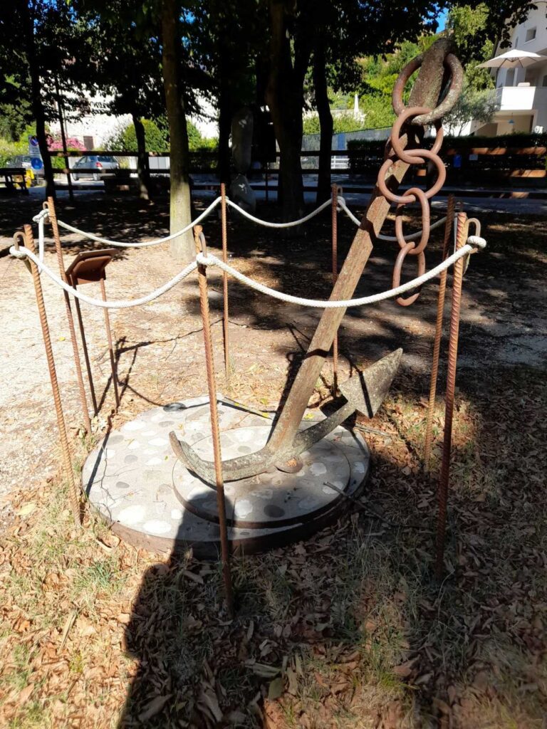
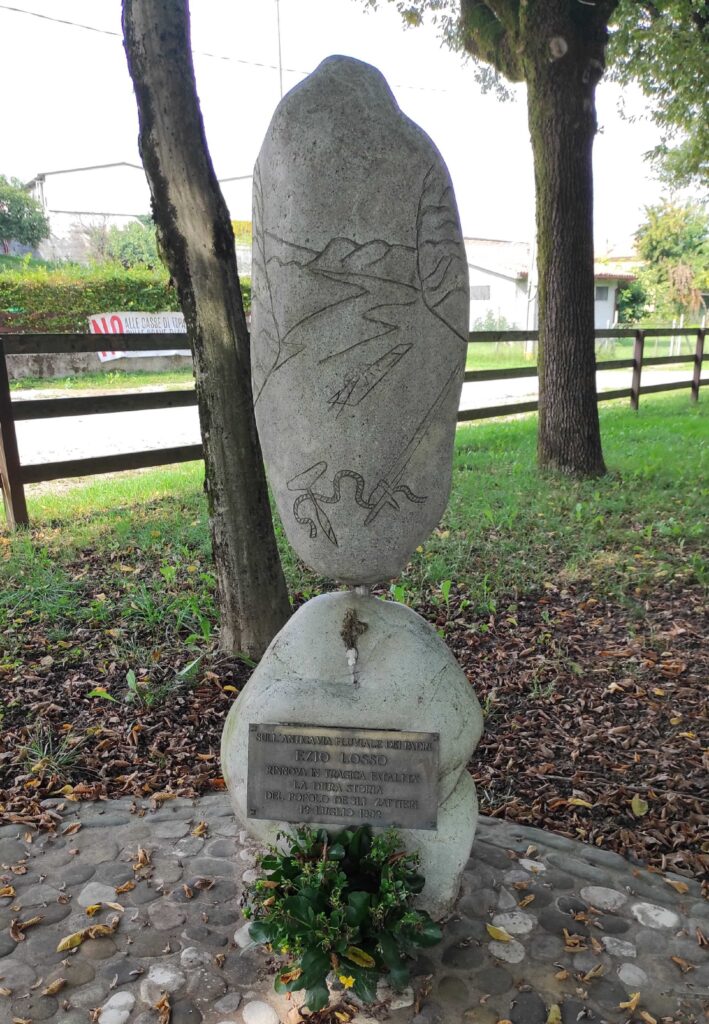
Oaks, lindens and hornbeams surround an anchor for mooring the pontoon boats of World War I, near which stands the monument dedicated to Ezio Losso, tragically disappeared on July 12, 1992 during the reenactment of a raft journey from Perarolo di Cadore to Venice. The event took place on the occasion of the five hundredth anniversary of the signing of the Statute of the Zattieri del Piave, ratified in Venice on August 3, 1492 by Doge Agostino Barbarigo.
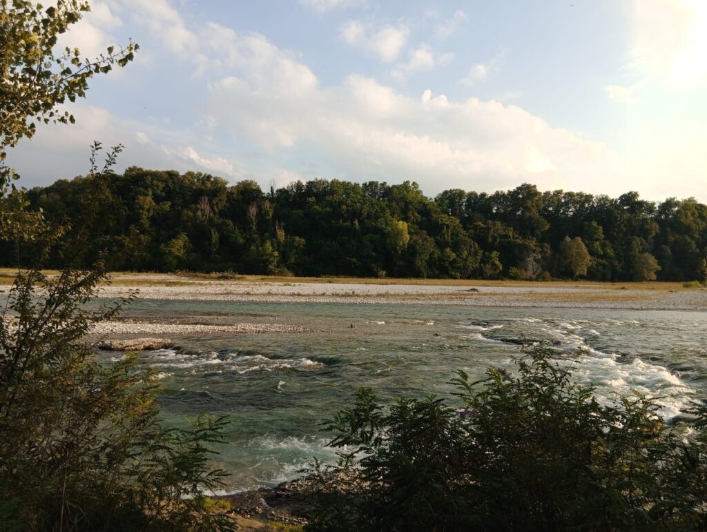
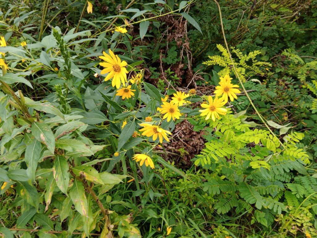
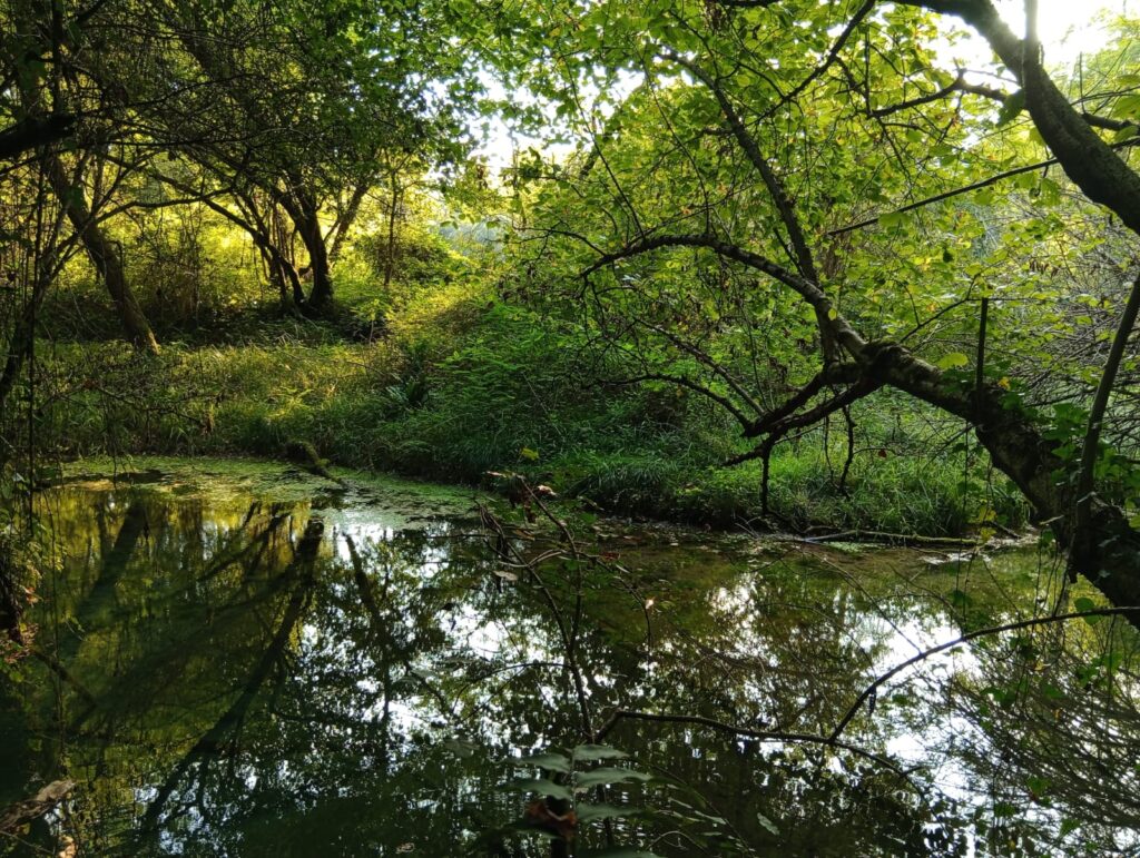
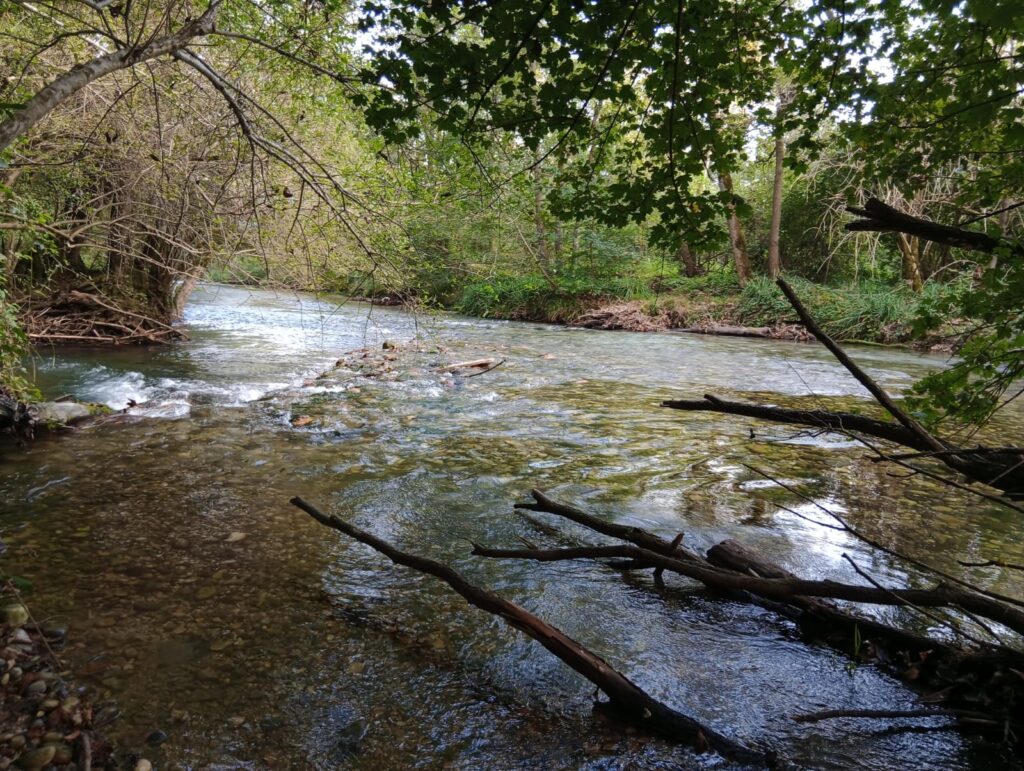
Looking south, one is enchanted by the dense tree cover that cloaks the northern slope of Montello. Dotted with river islets, the course of the Piave that flows at its feet laps the white expanse of the gravel beds, characterized by a grassy carpet reminiscent of steppe expanses dotted with bright floral species. Among these, purple loosestrife stands out for its lilac inflorescences, and Jerusalem artichokes for their bright yellow petals.
At the beginning of the route, two information panels each have a circular opening that directs the gaze to points of historical interest on the right bank of the river sacred to the Fatherland. The first crosshair frames Casa de Faveri, the starting point of the “Brigata Lucca” trail, along which there are numerous World War I positions.
The second indicates the direction of the Croda dei Zattieri, from which the raftsmen of Nervesa received the rafts to ferry to Ponte di Piave. During the Great War, a double machine gun position was built inside the croda.
This lush landscape forms the backdrop for the verses from the poem “Sul Piave” by Andrea Zanzotto:
“Faithful river
that announces and surpasses
the height of spring
with the overwhelming ardor of snowfields:” (vv. 1-4)
“Stay, human, with us. And cease. And let these waves
never return to the hymn. Never again.” (vv. 61-62)
The devastations and upheavals of the two world wars have not severed the intangible thread of oral traditions and popular beliefs that over the millennia have given life to the flourishing complex of fairy-tale creatures that inhabit the caves, watch over the woods and dwell in the crystalline springs of this unspoiled Oasis, and which we are now about to get to know more closely.
The Volpere Trail: the Piave, the Rosper, the cliffs
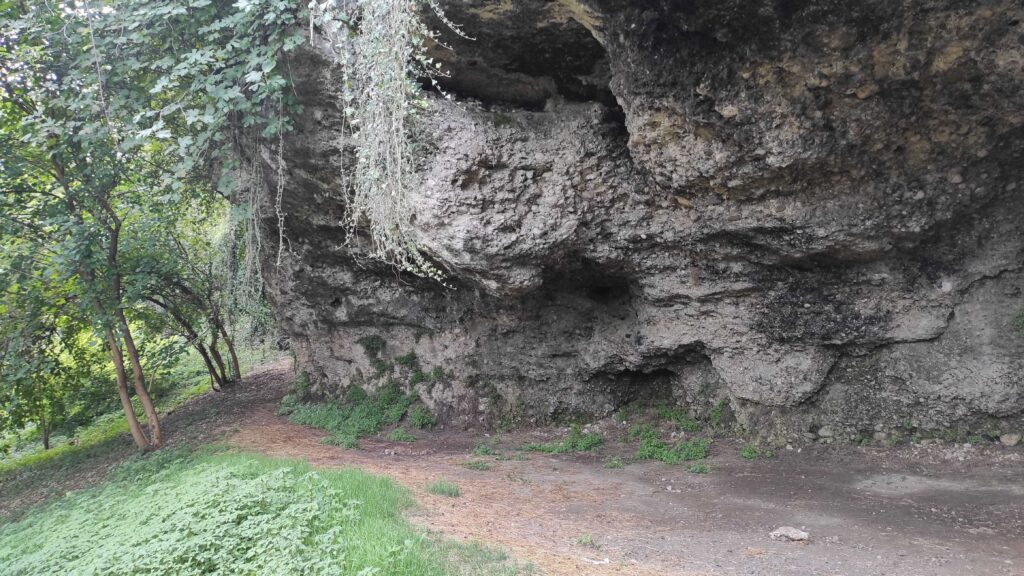
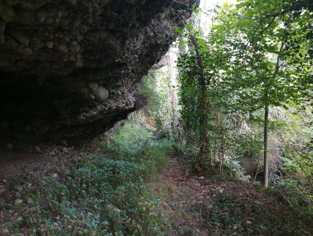
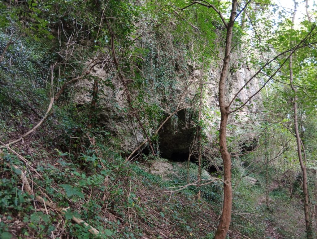
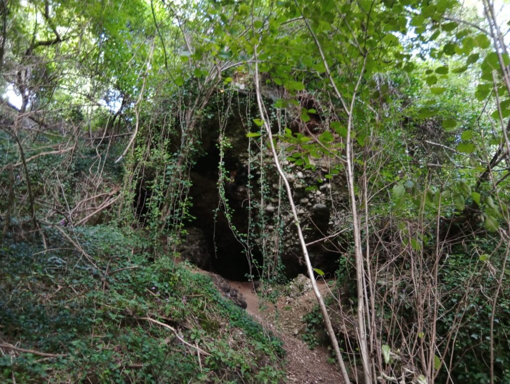
The route unfolds along the rock base known as “croda”, whose conglomerate walls are formed by pebbles bound by calcium carbonate. Resulting from the erosion of rain on the friable rock of the escarpment, the numerous natural cavities that open in the alluvial terrace offered shelter from the cold north winds to birds of prey, foxes (Vulpes vulpes), from which the trail takes its name, and from the end of the 5th millennium BC, to hunter tribes.
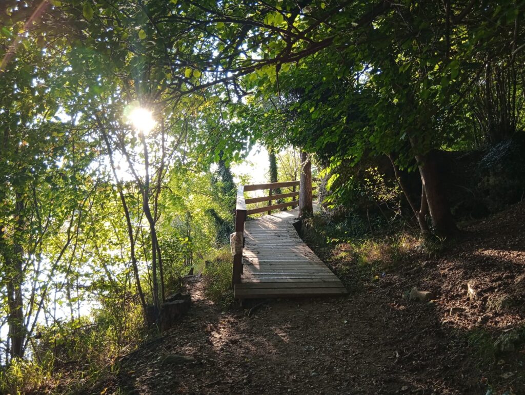
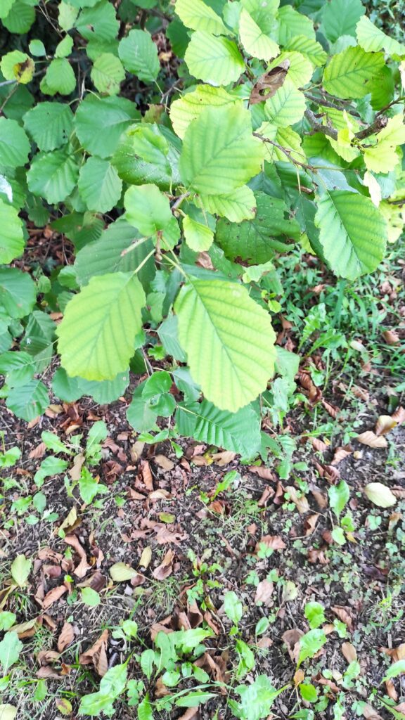
After crossing a comfortable slightly sloping wooden walkway, the winding itinerary unfolds among laurel, dogwood, field maple, oak, acacia, alder, mulberry, fig and hazel trees, whose foliage frames the steep walls of the rocky ridge overlooking the bed of the Piave River, where the Andro de Breda, Riparo Stella and Grotte Bertazzon open.
El Mazarol
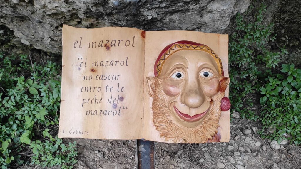
Known as Matharól in northern Veneto and as Salvanél in the south, el Mazarol is a mythical creature who taught men sheep farming and cheese making. Of short stature and human appearance, although sometimes depicted with goat legs, el Mazarol is distinguished by his characteristic red suit and his elusive nature. A skilled flute player, he expresses himself by speaking petèl, a disjointed language similar to that of infants. Guardian of the woods and the fauna that inhabit them, this legendary being moves with agility in the wild vegetation, deceiving hunters and leading them astray.
Spilling over the rocky walls of the escarpment, a cascade of ivy overlooks a deep cave, at whose entrance, placed on a lectern, is a book carved by Luciano Gobbato dedicated to the Mazarol, bearing an inscription that reads:
“el mazarol
no cascar
entro te le
peche del
mazarol”
From the next page emerges the smiling face of the mischievous elf, with a prominent nose, thick beard, pointed ears and characteristic red headdress.
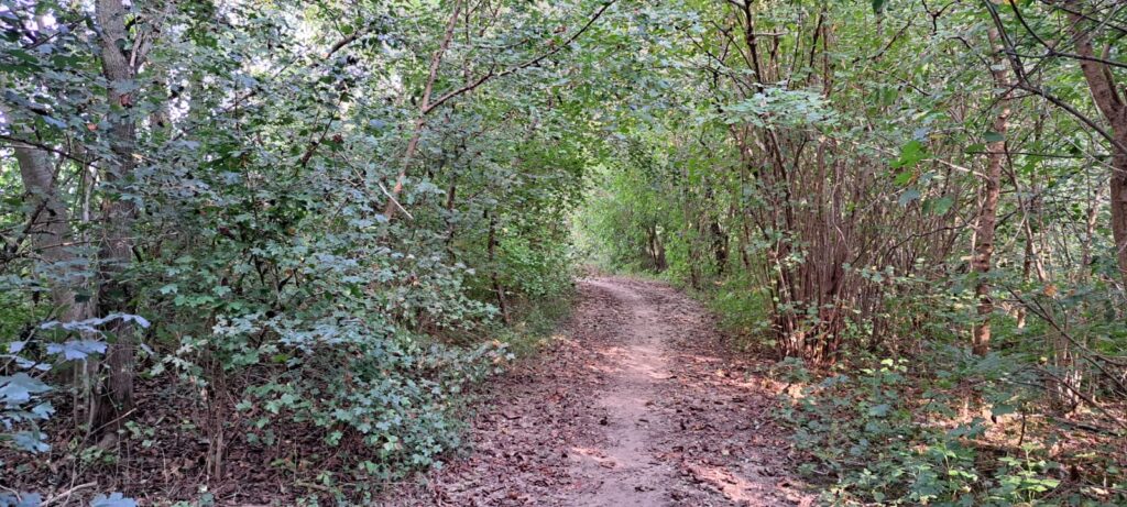
The path penetrates the vegetation of the riparian forest, whose silence is interrupted by the gentle rustle of the Rosper stream and the swaying fronds of oaks and towering poplars.
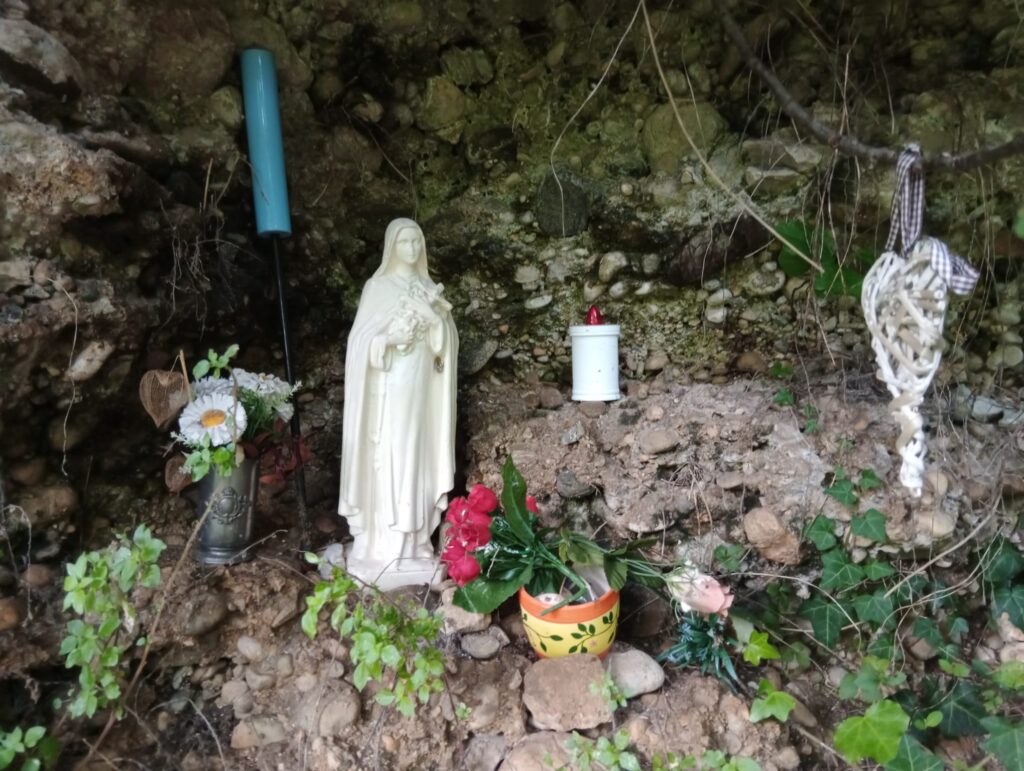
Winding staircases of wood and beaten earth defy the slopes of the cliff, offering the chance to observe its coves up close, one of which houses a votive image of the Madonna.
History of the Ancient Port of Falzè
The Middle Piave from the Paleolithic to the Iron Age
From the findings in the area it appears that the largest cave among these was inhabited by human settlements from the Paleolithic to the Iron Age. Craft villages specialized in flint working also arose on the top of the cliff, as attested by pottery fragments and waste from Neolithic artifacts made with this sedimentary rock based on silicon. Abundant in the Piave riverbed, it was used even before the Copper Age for the production of cutting, scraping and drilling tools.
Passo Barca from Roman times to the Middle Ages
Already documented by funerary inscriptions from Roman times, the activity of the raftsmen, who transported timber from the Dolomitic and Prealpine forests to the Adriatic shores, testifies to the importance of the Piave as a crossroads for communication and transport of people and goods. During the Middle Ages, the river was a privileged channel for the transit of livestock, wine, spices, amber, bronze, glass, Cadore minerals as well as forest products like mushrooms, chestnuts, honey and strawberries. The Piave was also an important river artery allowing pilgrims from all over Europe to reach Venice, from where they embarked for Jerusalem.
The Collalto Counts
In 1224, Rambaldo VII and his brothers purchased from the Municipality of Treviso the “passage of the Piave, the port and the market of Falzedo, with some buildings and many possessions“.
The boats used to ferry people and goods from one bank to the other included the barchetto, varying in length from five to six meters, the mezzana, up to ten meters long, and the large one, used for transporting herds and flocks, up to almost twenty meters long.
The boat of the Piave, from one bank to the other
Characterized by a pointed triangular bow, flat bottom, rectangular hull, square stern and slightly raised sides, the Piave boat is maneuvered with beech oars six to eight meters long. Topped with an iron tip, the poles were used to propel the boat from one shore to the other by levering on the riverbed.
Medieval transport and tariffs
In 1231, the taxation system for the passage of people and goods across the Piave River required a payment of two denarii for a man on foot, six for a man on horseback, while for foreigners the amount doubled.
In 1263, the passage of a loaded cart required a payment of four denarii, six denarii for a horse with packsaddle.
In 1377, the tables distinguished between ferry with low Piave and high Piave. The passage of a person on foot ranged from six denarii to one soldo, with horse from one to two soldi. For a loaded cart, the fee ranged from two to four soldi, while for large animals a fee of one to two soldi applied. A load of wine incurred a fee of five soldi, while for flocks of up to a hundred sheep eight soldi were paid. Again, foreigners were subject to double the rates.
When the raftsmen from Belluno docked at the port to carry out loading and unloading operations, they were replaced by the raftsmen from Nervesa, who completed the journey to the Lagoon.
The road network that developed from the river port led, proceeding east, to the castle of Collalto. Heading north, the Cal Zattera led to the pievi of Soligo and Sernaglia, while the Via Claudia Augusta extended parallel to the riverbank.
The forests of the Dominante
During the golden age of the Republic of Venice, the river port saw the passage of over three thousand rafts per year, which, in addition to transporting people and foodstuffs, ensured the supply of timber needed by the Dominante for the construction of palace foundations, ship hulls and oars.
Forest resources, whose jurisdiction was entrusted to the Arsenal house, formed the very foundations of the State. The oaks of Montello were used for the hulls of galleys, the firs of Cadore became the masts supporting the sails, and the beeches of Cansiglio the oars of the dogal fleet.
The middle course of the Piave in World War I
The defeat of Caporetto
Beginning at two in the morning on October 24, 1917 with shells loaded with phosgene gas, the offensive of the XIV Imperial Army on the Upper Isonzo front, between Plezzo and Tolmino, forced the Royal Army not only to give up the positions laboriously conquered on the Carso, Gorizia and the Bainsizza, but to retreat disorderly for about 150 km, leaving Friuli and eastern Veneto in Austro-German hands.
On November 9, 1917, the Royal Army mined the bridges on the river sacred to the Fatherland. Between November 16 and 17 it managed to repel the enemy, who prepared to winter on the Prealps and the left bank of the Piave, waiting for the offensive scheduled for spring-summer 1918. The attack planned to simultaneously strike the Asiago Plateau, the Grappa Massif and the Piave River.
The Battle of the Solstice
At three in the morning on June 15, 1918, 5,470 Austro-Hungarian guns opened fire on Italian positions from the Astico to the Piave.
At 5:10 a.m., the barges and pontoons for crossing the river were positioned. In Sernaglia della Battaglia, the 44th and 69th infantry regiments reached the right bank of the Piave and easily broke through the first lines.
Aided by dense fog and smoke grenades, the Austro-Hungarians reached Montello at Giavera, then advancing to Nervesa. After crossing the river between the Grave di Papadopoli and Fossalta di Piave, the imperial forces faced the tenacious Italian defense. At San Donà di Piave they pushed as far as Caposile.
The Italian counterattack was not long in coming. Allied artillery and aviation targeted the pontoon bridges, slowing the passage of supplies and reinforcements beyond the Piave, thus weakening the impetus of the enemy advance. Also hindering the imperial forces were the intense rains that between the night of June 17 and 19 raised the Piave level by 70 cm, submerging the river islands and making the construction of pontoon bridges impracticable.
On June 20, 1918, Emperor Charles I ordered a general retreat which was completed about three days later, during the night. In the Villa Jacur area, 5,000 men and four mountain batteries reached the left bank of the Piave.
The toll of the last Austro-Hungarian offensive on the Piave front was 19,300 Austrian and 23,200 Italian dead in eight days on Montello alone.
From World War II to the present
With the end of World War II, there was an intensification of crossings between the banks of the river, both on the occasion of traditional holidays, and to allow the inhabitants of the Quartier del Piave to reach their agricultural lands in Montello, and the inhabitants of Montello to go to the Falzè kiln where they worked.
The reduction of the river’s flow in summer, combined with the decline in river transport in this stretch of the middle Piave in the 1960s, led in 1970 to the definitive cessation of the ferryman’s activities, or barcarol.
The evolution of means of transport and communication routes, however, has not erased the historical craft and nautical knowledge of the raftsmen, whose ancient roots have been recognized by UNESCO as Intangible Cultural Heritage of Humanity.
The Anguane
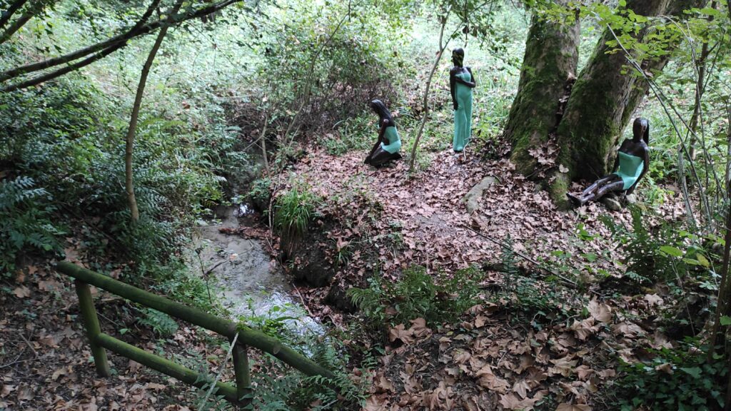
In addition to Matharol, local folklore includes the presence of the Anguane, whose name derives from the Latin Aquaneae, meaning “inhabitants of the waters”.
Represented from the waist up as women of long-limbed and sinuous build, the Anguane have a long eel-like tail instead of legs. They are characterized by slimy skin, dilatable pupils and flowing hair formed by threadlike algae.
Similar to the Homeric sirens, the Anguane are feared for their bewitching song, to defend against which, folk tradition prescribed the use of necklaces with intertwined viburnum twigs.
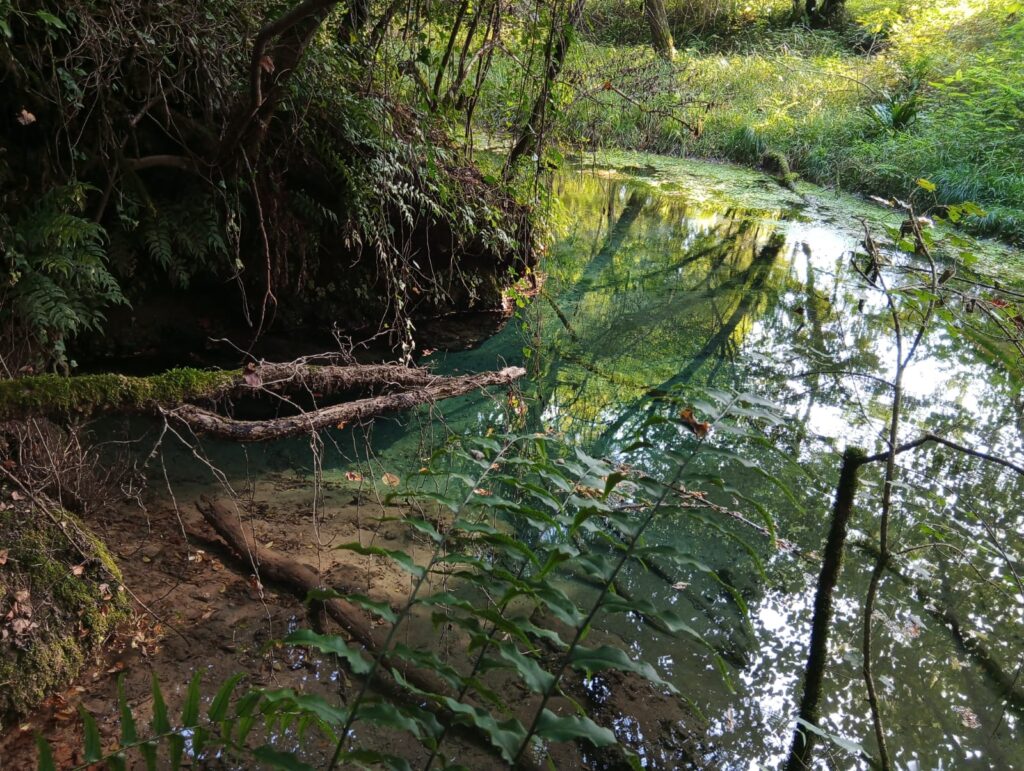
Fontana de Scapol and Fontana Stella
The trail is touched by the springs of the Volpére, belonging to the phreatic basin of the paleo-bed of the Soligo.
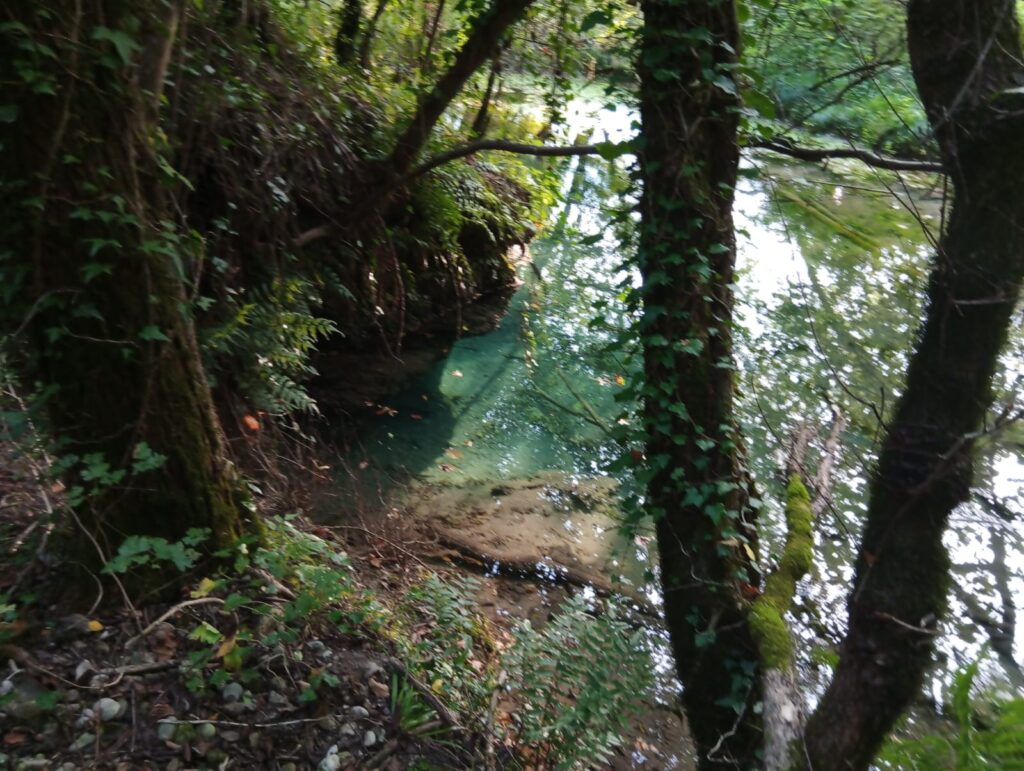
Two of the most photogenic spots on the itinerary are Fontana de Scapol and Fontana Stella, crystalline springs whose constant flow and stable temperature between 10 and 13 °C favor the development of lush riparian vegetation. Observing the clear springs, one is struck by the changing reflections that from the ochre of the sandy and gravelly bottom fade into sky blue and emerald green, up to dark blue in the deepest points.
Along the way, suggestive views of the Fontanon and the tip of the Volpere can be seen, in the nearby Oasi delle Fontane Bianche, of which the Rosper stream forms the natural boundary.
The route moves away from the Rosper stream and runs along the left bank of the Dolza for a stretch. Immersed in the dense forest vegetation, the path leads to a fork: keep left to reach a small group of houses on Via Fontigo.
Following the signs for Fontane Bianche, the trail opens onto the rural landscape of Sernaglia dotted with farmhouses surrounded by fields of wheat and corn from which some amaranth plants emerge, with their characteristic dark red inflorescences.
The path re-enters the woodland vegetation touched by the Dolza stream until it emerges onto Via Fontane Bianche. At this point we turn left towards Molino Vecio in Val, a short distance from the loop path of the Fontane Bianche nature Oasis.